Project Info
Project Description
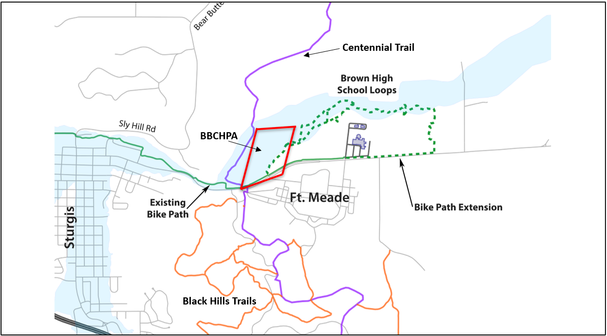
Bear Butte Creek Historic Preserve Trails
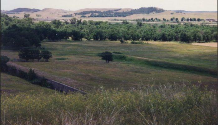
Bear Butte Creek flows through a narrow canyon in the Black Hills hogback, providing a long-important entry point into the Black Hills from the surrounding prairies. Trails and roads have traversed this area for hundreds of years. Today, the canyon is locally known as the “S-Curves,” and connects the town of Sturgis to its high school and the Fort Meade VA Medical Center, along with points east and north.
Map of Trails
Bismarck-Deadwood Stage Trail
According to the State Historical Society of North Dakota, “In 1877, when the Black Hills were opened to those in search of gold, the Bismarck-Deadwood Stage Trail was established. As it was the closest rail end, the Northwestern Express, Stage, and Transportation Company and several independent freighters began operating stage lines moving people, mail, and freight from Bismarck. The route encompassed over 200 miles. Fare from Bismarck to Deadwood was around $23, and the journey lasted around 40 hours. For a period, stages were running daily.”
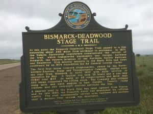
Bismarck – Deadwood Stage Trail Marker Credit: Historical Marker Database
Centennial Bike Path
The Centennial Bike Path is part of Sturgis’ bike path system, and runs over four miles from the northwestern part of town, along the south side of the Bear Butte Creek Historic Preserve, to Sturgis Brown High School.
Photo Coming Soon
Centennial Trail
The Centennial Trail was established to mark the 100th anniversary of South Dakota statehood (1889 to 1989). According to the SD Department of Game, Fish and Parks, “The 111-mile trail represents the diversity of South Dakota. The Trail crosses the prairie grasslands near Bear Butte State Park and climbs into the Black Hills high country, skirting lakes and streams until it reaches Wind Cave National Park near Hot Springs. The Forest Service, Bureau of Land Management, National Park Service, and South Dakota Department of Game, Fish and Parks have combined their efforts to develop this Trail for you to enjoy.”
A trailhead with parking lot is located at the intersection of Old Soldier Road and Hwy 34 (East Lazelle Street). A pedestrian underpass connects the parking lot to the trails and Preserve.
Photo Coming Soon
Connecting Fort Meade and Sturgis
Since their founding in 1878, Fort Meade and Sturgis have been connected through the narrow canyon, which has served as the only link between the two and farther points east and west. Today it is a vital connection between Sturgis and the Fort Meade VA Medical Center, Sturgis Brown High School, and multiple venues and campgrounds during the annual Sturgis Motorcycle Rally.
Photo Coming Soon
Ft. Meade Bike Trail
Black Hills Trails constructed a bicycle trail around Fort Meade, connecting to both the Centennial Bike Path and the Centennial Trail.
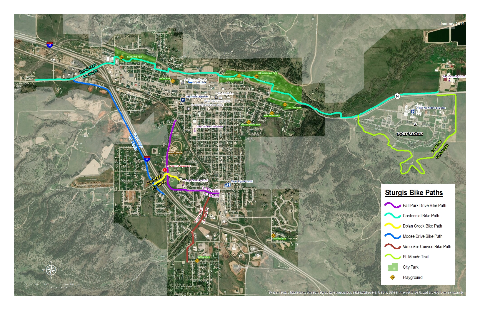
Ft. Meade Bike Trail
Floods
Water from heavy spring runoff often floods out of the banks of Bear Butte Creek, washing out bridges, flooding roads, and sometimes buildings. Every few years, the “S-Curves” floods, cutting off the Fort Meade VA Medical Center and Sturgis Brown High School from Sturgis.
The Bear Butte Creek Historic Preserve presents an opportunity to educate local residents and students about the hydrology of Bear Butte Creek and a restoration of the natural creek channel.
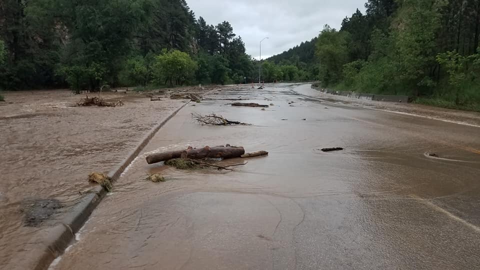
S Curves Flooded 2019
Old Highway 34
Probably originally following the old Bismarck-Deadwood Stage Trail, South Dakota Highway 34 (and later 79) came through the Bear Butte Creek Historic Preserve area, crossing Bear Butte Creek at various points over the years, depending on that season’s water levels and floods.